Ride · Hike · Explore · Belong
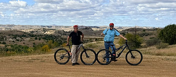
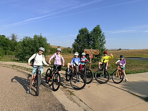
Singletrack cutting through the North Dakota badlands
Back to trails
The whole trail, in detail

Maah Daah Hey Trail

How the trail came to be, the rides we send riders to first, the shuttle stops that get you there, and the maps worth having in your pocket.

Historical timeline

From an idea to 144 miles

  1. 1960s–1992

    The idea of linking TRNP's North and South Units with the Elkhorn Ranch takes shape, and planning finally clears the way for construction.

  2. 1995

    Construction begins. Jen and Loren Morlock are already deep in North Dakota trail advocacy.

  3. 1995–1999

    The Forest Service and state partners build the original route; Dakota Cyclery puts the Badlands in front of visitors and media.

  4. 1999

    The original trail is finished at about 96 miles. Jen Morlock joins the early association board.

  5. 2000–2002

    The trail association forms, Dakota Cyclery wins the first guided-tour and shuttle permit, and the trail earns National Recreation Trail status.

  6. 2004

    Jen and Loren make Medora home, deepening Dakota Cyclery's local roots.

  7. 2007–2014

    The Southern Extension is planned, built and opened.

  8. 2015

    The final connection completes the system at roughly 144 miles.

  9. 2012–2025

    Volunteers, agencies and conservation groups keep the trail maintained and stewarded.

  10. 2025–2026

    The association marks 25 years, and Dakota Cyclery's legacy continues as Dakota Cycling Adventures under Julie and Jairo Ramos Lagos.

The people and organizations behind the trail

USDA Forest Service

Original planning, construction and public-land management.

North Dakota Parks and Recreation

State recreation partnerships and trail development.

Maah Daah Hey Trail Association

Advocacy, fundraising, infrastructure and maintenance.

Jen and Loren Morlock

Early advocates, association leadership, guiding, shuttles and promotion.

Save the Maah Daah Hey

Grassroots volunteer maintenance and stewardship.

Badlands Conservation Alliance

Conservation advocacy for the Badlands.

Theodore Roosevelt Medora Foundation

Tourism development and promotion.

North Dakota Tourism

Statewide promotion of the Badlands and the trail.

Built through collaboration, and kept alive by generations committed to protecting and sharing the Badlands.

Beginner & intermediate favorites

Two trailheads to start with

Not everyone needs all 144 miles. These are the stretches we put first-timers and visiting riders on — both finish with a ride back to the shop in Medora for a cold drink and a bike wash.

Buffalo Gap Trailhead
Beginner to intermediate

Buffalo Gap Trailhead

Our most requested starting point. Gentle rolling climbs, wide-open views and forgiving clay doubletrack make it an easy intro to the badlands, and it keeps every group happy.

Ride it as an out-and-back or link it back toward Medora for a full day on the trail.

Plumley Draw Trailhead
Intermediate favorite

Plumley Draw Trailhead

A local favorite with a little more climbing and a lot more payoff. Ridges, draws and fast flowing singletrack where every small grunt is rewarded by an equally twisty downhill, with a finish that rolls right back to the shop in Medora.

Best ridden with a shuttle drop so you can enjoy the descent instead of saving legs for the road.

Shuttle destinations

Where we drop you off

The Maah Daah Hey — North Dakota's IMBA-designated Epic — runs rough singletrack through grass and clay, split into nine trail units of varying size and difficulty, with spur trails, campgrounds and trailheads spread across the whole length. We shuttle to all of them — tell us where you want to start and where you want to finish.

Coming soon

Badlands Gateway Trailhead

A new trailhead at the Theodore Roosevelt Presidential Library in Medora, opening the north end of the trail system right where the story starts. We will be running drops there as soon as it opens.

Trail units — north to south

  • The Wolf · North of the national park8.8 mi
  • Long X · CCC Campground5.8 mi
  • Summit Overlook · Out and back3.8 mi
  • Maah Daah Hey · The main line144 mi
  • Bennett3.2 mi
  • Cottonwood6.9 mi
  • Ice Cave1.5 mi
  • Buffalo Gap · + 2 mile campground spur18.9 mi
  • Coal Creek Campground1.9 mi

Trailheads & campgrounds — south to north

  • Burning Coal Vein CG · Southern terminusMM 00
  • Third Creek TrailheadMM 7
  • Tom's Wash TrailheadMM 15–16
  • Bear Creek TrailheadMM 23
  • Coal Creek CGMM 29
  • Plumley DrawMM 33
  • Crying Butte Trailhead · NewMM 43
  • Bully Pulpit TrailheadMM 45
  • RoughRider State ParkMM 47
  • Buffalo Gap CG / Trailhead · On the Buffalo Gap TrailMM 8
  • Wannagan CGMM 64–65
  • 722 Road Cache BoxMM 77
  • Elkhorn CG · Remote siteMM 85–86
  • Magpie CG · Remote siteMM 105–106
  • Beicegal Road Cache BoxMM 119
  • Bennett CG · Remote siteMM 130
  • CCC CG · Remote siteMM 144